Fundamentals of Geographic Information Systems (GIS) for Planners, Engineers & Land Surveyors
DISCLAIMER
Before undertaking any on-demand effort, you should review the rules of your licensing/certifying entity.
It’s your responsibility to determine whether this on-demand course meets your continuing education requirements.
You must take and pass a quiz to receive credit. You can take the quiz as many times as needed and there is no time limit on the quiz.
Once the quiz is completed, you will be asked to download your certificate.
**Any on-demand programs that qualify for AIA or LACES credit will require an additional 2 business weeks for processing.
**AIA credit is not available in USB format.
Streamable MP4/PDF
You will receive an automated email letting you know when your On-Demand package is available approximately 3 business days after the date of the live event or the date of your order, whichever is later. This email will contain links to the video recording, materials, and program quiz.
To track your purchase, you will need to create an account on the website using the email address used for your registration.
For AIA requirements only, the on-demand recording will have occasional question prompts that will not allow the video to progress unless they are answered, and you will not be able to skip forward while watching the video.
Please note, if you attempt to resume watching the video on a separate device, your progress will not be saved.
Click the link which appears at the end of the video to be taken to the course quiz.
You will have unlimited access to the on-demand video recording, and it will never expire.
**Any streamable on-demand programs that qualify for AIA or LACES credit will require an additional 2 business weeks for processing.
USB MP4/PDF
HalfMoon will mail these materials via USPS.
USB orders ship approximately 3 business days after the program takes place or after the order is placed, whichever date is later. Please allow an additional 7-10 business days for shipping.
The link to the quiz will be available in a PDF in your USB drive marked QUIZ.
HalfMoon will contact you and issue a full refund if the product you ordered is not available. However, refunds will not be issued if completion certificates are requested.
Please contact HalfMoon Education if you have any questions during the process of taking this course. (715) 835-5900 or qchapman@halfmoonseminars.org
**Any USB on-demand programs that qualify for LACES credit will require an additional 2 business weeks for processing.
**AIA credit is not available in USB format.
Agenda
Webinar instructions will be emailed before the date of the webinar.
Please log into the webinar 15 – 30 minutes before start time.
Friday August 25, 2023
9:00 am – 4:20 pm CDT
Presented by: Joseph Kerski
Spatial is Special!
- GIS definitions
- What are maps?
- Why are they relevant to 21st Century decision making?
- GIS software and organizations
- The whys of where
- Activity 1: Spatial and attribute characteristics
- The modern GIS platform: Maps, layers, apps, data services
Let’s Get Mapping!
- Activity 2: A field survey, map, dashboard, and story map
- Activity 3: Symbiology: Single symbol, graduated symbol, predominance maps, pie charts, ring chart maps
- Activity 4: Creating expressions; analyzing change over space and time
- Activity 5: Filtering data and working with isolines
Investigating Relationships
- Activity 6: Bivariate and relationship mapping
- Activity 7: Analyzing relationships with scatter plots and maps
How to get Data into a GIS
- Activity 8: Mapping a spreadsheet
- Discussion: Vector data, imagery, raster data
- Activity 9: Creating a field survey and online map
- Mappy Time! My favorite maps and map-related books. What are yours?
Communicating Your Results
- Demonstrate: Web Mapping applications including Living Atlas of the World apps
- Activity 10: Creating a dashboard
- Activity 11: Creating a story map
- Activity 12: Spatial Analysis I: Natural Hazards
- Discussion on sharing – when and how to do it
Spatial Analysis
- Activity 13: Spatial Analysis II : Invasive species
- Activity 14: Deep learning feature extraction from satellite imagery
- Activity 15: 3D scenes and views
GIS Workflows and Considerations
- GIS content organization
- ArcGIS Pro and GIS tools
- Data quality and the ethics of mapping
- Continuing your GIS journey
- Books, organizations, tutorials
- Associations, networks, events
Webinar Instructions
All attendees must log-on through their own email – attendees may not watch together if they wish to earn continuing education credit. HalfMoon Education Inc. must be able to prove attendance if either the attendee or HalfMoon Education Inc. is audited.
Certificates of completion can be downloaded in PDF form upon passing a short quiz. A link to the quiz will be sent to each qualifying attendee immediately after the webinar. The certificate can be downloaded from the Results page of the quiz upon scoring 80% or higher.
Webinars are presented via GoToWebinar, an easy-to-use application that can be run on most systems and tablets. Instructions and login information will be provided in an email sent close to the date of the webinar. It is highly recommended that you download, install and test the application before the webinar begins by clicking on the link in the email.
GoToWebinar App requirements:
Windows 7 – 10 or Mac OSX Mavericks (10.9) – macOS Catalina (10.15)
Web Browser:
The two most recent version of the following browsers:
Google Chrome, Mozilla Firefox, Apple Safari, Microsoft Edge
Internet Explorer v11 (or later) with Flash enabled
Internet connection: Minimum of 1Mbps Hardware: 2GB RAM or more
For more information, visit the Support section at www.gotowebinar.com
Credits
Professional Engineers
6.5 PDHs
Land Surveyors
6.5 PDHs
Certified Planners
CM|6.5
Continuing Education Credit Information
This webinar is open to the public and is designed to qualify for 6.0 PDHs for professional engineers and land surveyors in most states. This course is not approved in New York; please refer to specific state rules to determine eligibility.
HalfMoon Education is an approved continuing education sponsor for engineers in Florida (Provider No. 0004647), Indiana (License No. CE21700059), Maryland, New Jersey (Approval No. 24GP00000700) and North Carolina (S-0130). HalfMoon Education is an approved continuing education sponsor for land surveyors licensed in Indiana (License No. CE10600325), Maryland, and North Carolina (S-0130).
This webinar has been submitted to the Florida Board of Professional Surveyors and Mappers for registration and to the Missouri Board for Architects, Professional Engineers, Professional Land Surveyors and Professional Landscape Architects for pre-approval, which are currently pending.
HalfMoon Education is an approved CM Provider with the American Planning Association. This course is registered for CM|6.5 for Certified Planners.
Attendance will be monitored, and attendance certificates will be available after the webinar for those who attend the entire course and score a minimum 80% on the quiz that follows the course (multiple attempts allowed).
Speakers
Joseph Kerski, PhD, GISP, M.A., BA
Ph.D. in Geography (University of Colorado Boulder), M.A. in Geography (University of Kansas), B.A. in Geography (University of Colorado Boulder)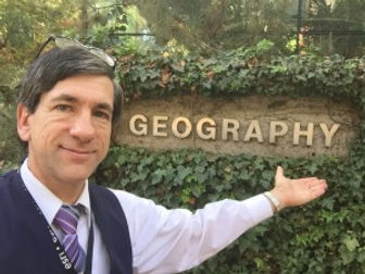 Dr. Kerski is a geographer and educator focused on GIS-based curriculum development, research in the effectiveness of GIS in education; professional development for educators; communication about the need for geographic skills, tools, and perspectives through keynote addresses, articles, social media, and workshops; and fostering partnerships to support GIS in education. He has given two TED talks and has created over 5,000 geo-related videos. Dr. Kerski also teaches online and face-to-face courses at primary and secondary schools, through MOOCs, and universities such as Sinte Gleska University, Penn State, and the University of Denver. He is active in educational nonprofit organizations, including NAAEE, AAG, and NCSS, and he served as president of the National Council for Geographic Education. After serving as geographer at NOAA, US Census Bureau, and USGS, since 2006 Dr Kerski has served as education manager for Esri, providing thought leadership in geospatial technologies in formal and informal education at all levels, internationally. He has written books such as Interpreting Our World, Spatial Mathematics, International Perspectives on Teaching and Learning with GIS in Secondary Schools, The Essentials of the Environment, Tribal GIS, and The GIS Guide to Public Domain Data. As a lifelong learner, Dr Kerski feels as though he’s just getting started and thus actively seeks mentors, partners, and collaborators.